The Smell of Death

It’s not often that the smell of Biggles’ farts is welcome, but on Sunday we were longing for the heady aroma of overcooked cabbage.

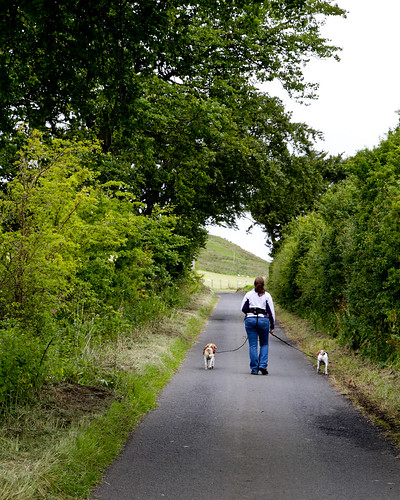
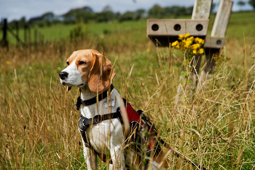
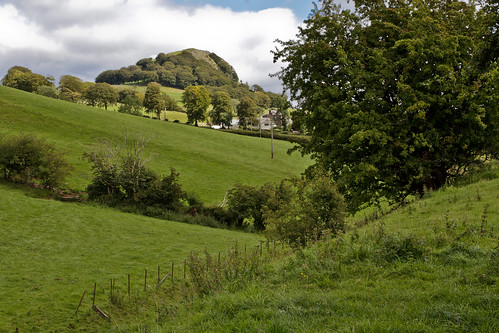
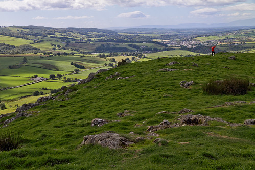
We frequently drive past nearby Loudoun Hill and on Sunday we decided to enjoy the views from the top. We parked up at nearby Darvel to walk along the old railway line to the hill – a round trip of about 7 or 8 miles.

IMG_9746
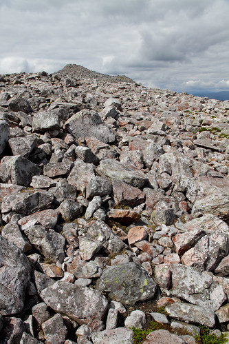
Loudoun Hill from the old railway track near Darvel

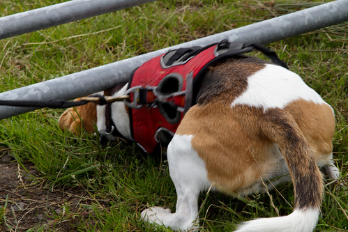
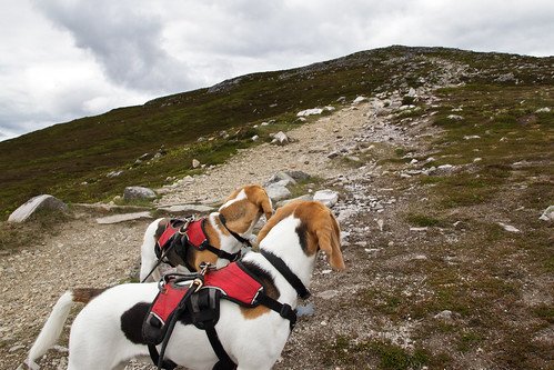
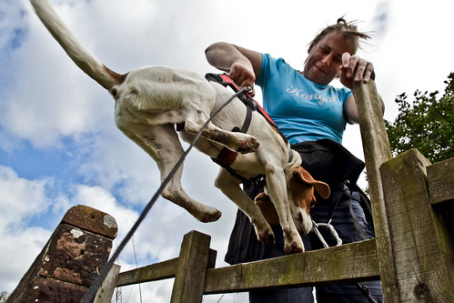
While we stopped to take the photo above Beanie and Biggles began frantically rolling in the grass. A closer inspection revealed the reason for their enthusiasm:

IMG_9758
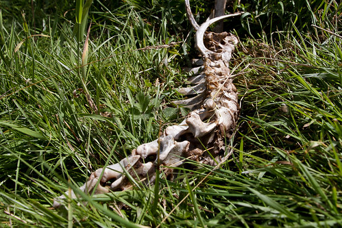
The well rotted carcass of a sheep

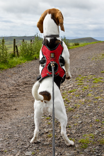
The smell was vile and we spent the rest of the walk trying to stay up wind of the pups. We tried to get them to roll in cow dung in the hope that it would mask the smell of death but our Beaglets were very proud of their lovely new scent and didn’t want to spoil it.

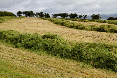
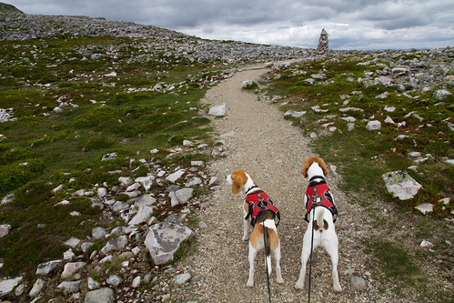
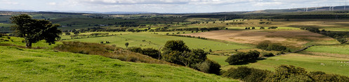
The old railway closed in the 1930’s and now it’s just a grass track running through farmland. We stopped several times to admire the views.

IMG_9772

IMG_9773

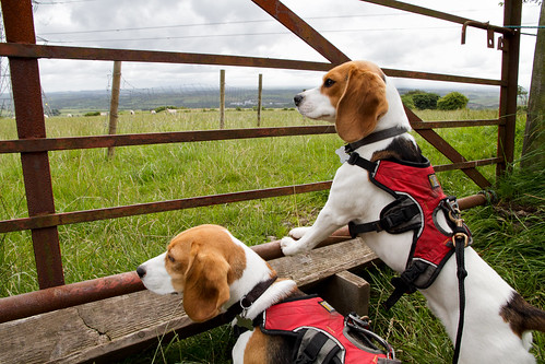
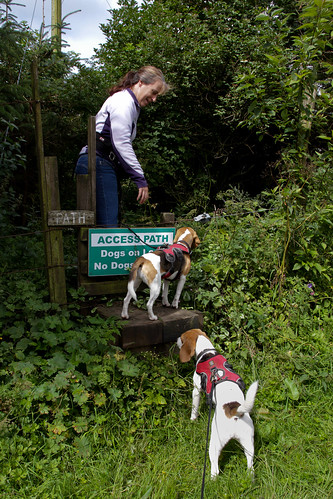
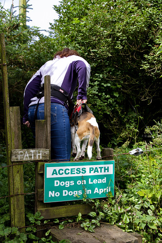
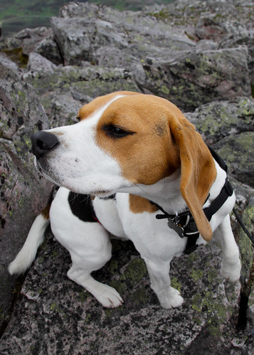
There were lots of stiles to lift our stinky pups over:

IMG_9783

I was half way over this one with Beanie when Paul spotted the notice advising walkers to take a detour to avoid the horse.

IMG_9788

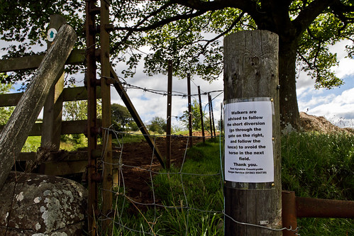
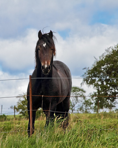
We took the alternative route which took us through a field alongside the railway track. Just moments later the meanest, biggest, angriest black stallion appeared on the railway track. Beanie and Biggles barked frantically and the horse pounded it’s hooves and galloped up and down the railway track looking for a way to get through the fence. I’ve never seen a horse look so menacing.

IMG_9797

IMG_9800

We moved on briskly. Loudon Hill was now getting closer.

IMG_9809

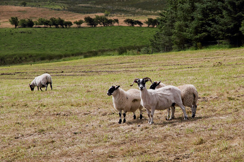
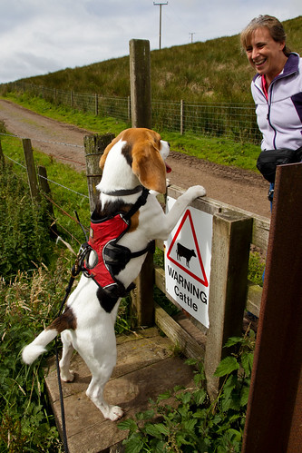
As we approached the hill we left the railway track to walk along farm roads. The fields were full of cattle – young males I think. They were all very interested in Beanie and Biggles and came stampeding over to the fence for a closer look.

IMG_9844_stitch

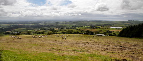
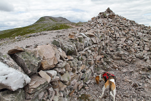
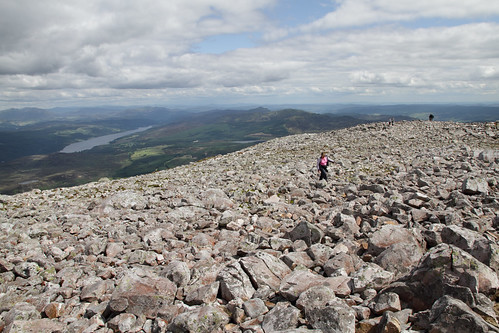
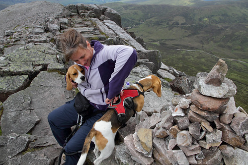
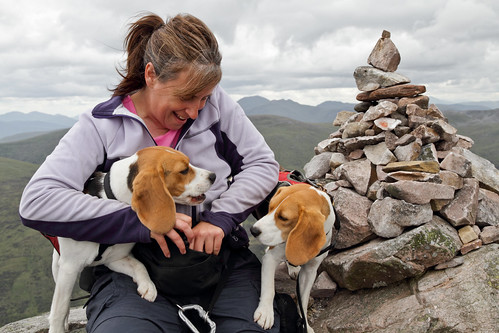
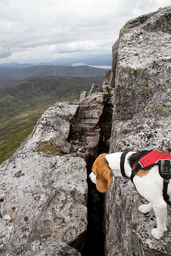
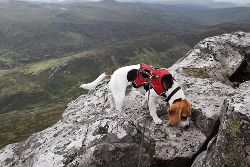
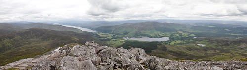
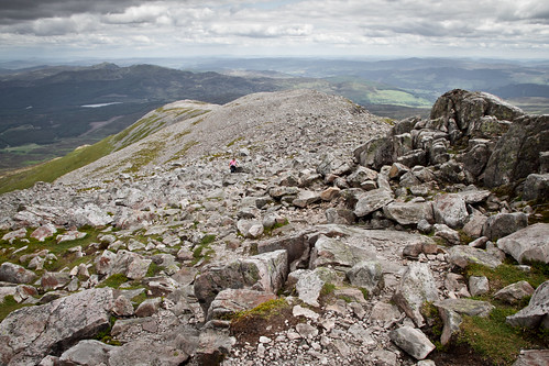
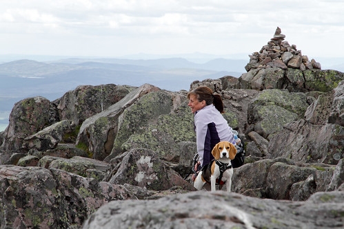
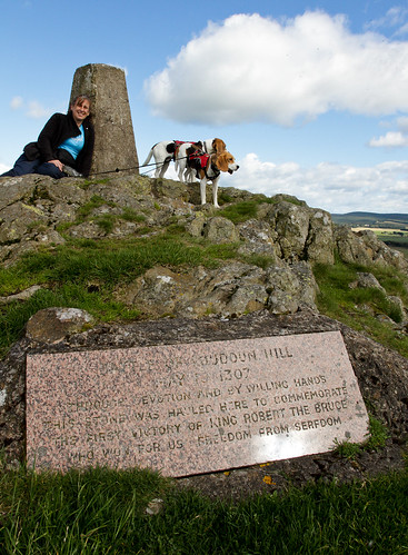
Eventually we got to the hill. It’s a short but steep climb up and the views from the top are amazing.

IMG_9904_stitch

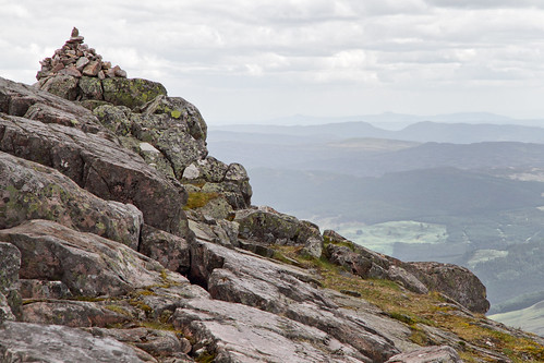
The Battle of Loudoun Hill was fought in May 1307 between a Scots force led by Robert Bruce and the English commanded by Aymer de Valence. It took place beneath Loudoun Hill, and ended in a victory for Bruce. There’s a plaque to commemorate the battle at the top of the hill.

IMG_9883

IMG_9917

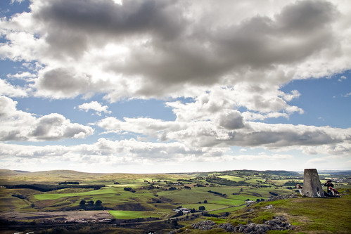
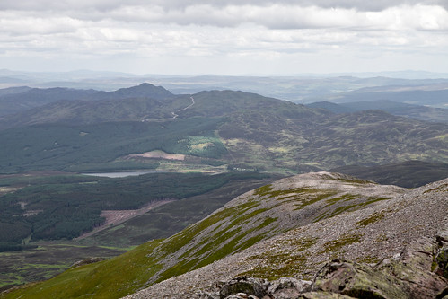
This one’s looking back towards Irvine bay (where we live):
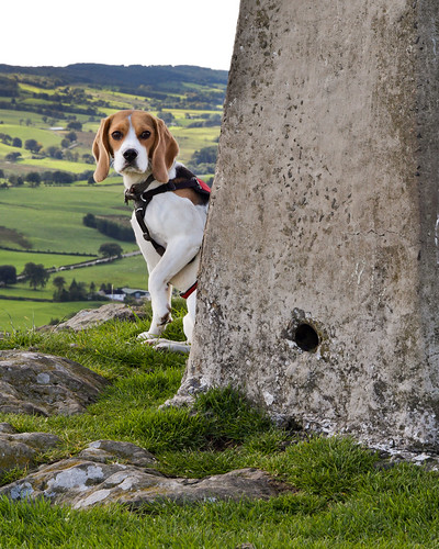
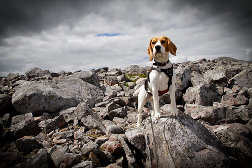
IMG_9863

IMG_9921
Peek-a-boo!

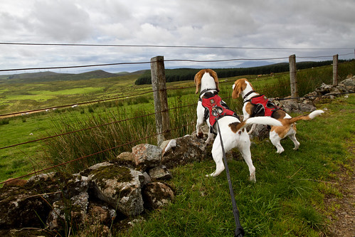
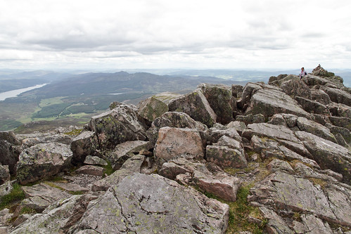
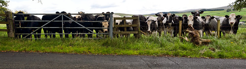
We spent about an hour on Loudon Hill chatting to other walkers. We then retraced our steps back to Darvel and our car. I was a bit nervous about crossing the field beside the black stallion and sure enough, he was lying in wait for us. I was convinced he was going to jump the fence to get to us at one point. And of course, Beanie and Biggles wound him up by barking. A few minute after escaping the stallion we heard a drumming of hooves….LOTS of hooves. A herd of cattle stampeded over to get a closer look at our very noisy Beagles. Fortunately there was a fence separating their field from the railway track!

IMG_9846

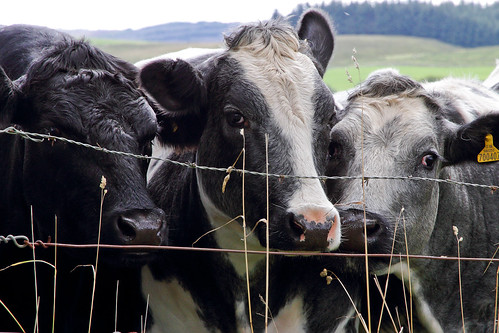
I’m sure they were just curious, but the jostled and pushed to try and get close to the fence for a better view. Every so often they’d charge away from the fence and then come stampeding back. It was quite unnerving being so close to them. And of course, Beanie and Biggles continued to bark, howl and bay. But there was a fence there. Nothing to worry about. And then…..

….the fence stopped. We were in the field with a herd of large cattle that were hell bent on getting a close look at our noisy hounds. We legged it up the steep railway embankment and fortunately most of the cattle stopped following. One particularly curious one followed us for a while but he eventually gave up.

A lovely walk, but watch out for the farm animals!

Baidland Hill Walk

We both fancied going somewhere new for our morning walk this morning. Google turned up the Baidland Hill Walk which was described as a 2 hour, 5.5 km walk in the hills around Dalry with panoramic views over Ayrshire and of the sea. And only a few miles down the road from us – ideal!

It was a bit of a grey morning but a nice temperature for walking. The walk started out in the village of Dalry and then out along picturesque country roads for a while before turning off onto the “Velvet Path Walk”. At this point we wondered if we’d taken a wrong turn as the path was very overgrown – at places it was hard to pass through the brambles and stinging nettles. But Beanie and Biggles seemed to enjoy scrambling through the undergrowth so we pushed on. And in fact we did eventually emerge onto another quiet country road as described in the guide.

IMG_7826

The surrounding fields were full of sheep and we stopped regularly for a good look and an occasional ‘aaarrrfff, aarrrrfff!’.

IMG_7812

IMG_7873

IMG_7883

IMG_7871

IMG_7864

At time special measures were necessary in order to get an optimal view.

IMG_7868
Can’t quite see…!

IMG_7863
If I can just squeeze under here….

As the walk progressed and we gained height the scenery changed from hedgerows and fields to views over the Ayrshire countryside.

IMG_7842

IMG_7857

Eventually we reached a series of styles and Beanie and Biggles harnesses proved to be very handy for helping them over.

IMG_7843

IMG_7844

IMG_7850

We were now on a wide track with fields full of sheep either side. The views really started to open up now. On a sunny day with blue skies it would be stunning. The photo below doesn’t do it justice as you can’t easily make out the sea and islands all the way along the horizon line.

IMG_7876

By this point the guide said we should enter a coniferous forest but there was no sign of it. We’d already been walking for nearly 2 hours and according to our satnav there was still another 2 hours to get back to the car! Luckily we bumped into some workers some way along the track and they explained that the forest had been cut down several years ago to build a wind farm. The old route described in our guide no longer existed, but we could follow the wind farm tracks back onto the road to Dalry. So our 5km walk turned out to be 15 km and the 2 hours extended to 3.5 hours – but it was well worth the time and effort. Definitely one to do again!

IMG_7886

Schiehallion

IMG_6781_HDR

Schiehallion comes in at number 6 on this handy page of “easy” munros. A bit of Googling got us a more complete description of the walk than that site provides, and crucially, satnav coords (Lat 56°40’32.88″, Long -4°2’9.6″) to the car park at the start of the walk. As previous posts have shown we’re both really good at getting lost, so precise satnav directions are always a boon. I know these gizmos can sometimes let you down, but since replacing  the standard female voice with that of Mr T I’ve been even happier to entrust all navigation to the power of satnav. Can you imagine Mr T ever getting lost? No way fool!

All the write-ups I could find for this walk enthuse about the quality of the recently upgraded path. Some note that the path doesn’t go all the way to the summit, but still rate the walk as pretty unchallenging. This created a vision of an easy 4-5 hour stroll in our heads, and the first hour or so of walking matched our expectations. The path was just great – some sections were steep and kind of monotonous, but it was shaping up to be the easiest munro we’ve done.

IMG_6746

A while further on we hit a little plateau with a cairn on it:

IMG_6753

IMG_6757

That cairn effectively marked the end of the clear path we’d been on so far. From here on in you mostly had to pick your own way through an increasingly boulder-strewn landscape.

IMG_6766

Some of the time a trail of rubble indicated the way forward, and after a while we had the reassurance of another cairn, this time with a short wall extending out from it. I have no idea what the wall was for, but apparently it smelled quite nice.

IMG_6771

From this point there was never any doubt about which way to go – we just had to follow the ridge up to the top. I was very glad we both had substantial walking boots though; some of the rocks were loose and it would’ve been quite easy to end up with a sprained ankle.

IMG_6783

The best way to make good progress was to dodge the rubble and aim to step on only the more substantial rocks. Easier said than done when you’ve got a couple of eager Beagles trying to pull you in different directions! In the end I decided to stop trying to lead the way and pretty much followed Biggles. He seemed to favor the bigger stones, whereas Beanie seemed determined to weave her way through every little nook and cranny.

IMG_6788

Biggles – the ultimate Sherpa Beagle

I must admit I started to really enjoy walking over all those rocks. Having to pick and choose every step took my mind off the effort of the climb, turning it almost into a game. At one point we saw another cairn above us and for a second we wondered if it marked the summit, but it was just an impostor. A little further on we found another, though this one was obviously a fake. I was very doubtful when I saw yet another, but this time there was nowhere to go beyond it and I realized we’d finally hit the top.

IMG_6785

Not too far now!

IMG_6910

The last cairn!

SchiePano2

Made it!

Obviously it was time for treats and some bold exploration:

IMG_6843

IMG_6854

IMG_6802

IMG_6811

IMG_6821

IMG_6795

Some more shots from the top:

SchiePano4

IMG_6794

IMG_6897

IMG_6933

IMG_6941

IMG_6911

The way down was straightforward if a little hard on the knees, and back at the bottom I was tired but my leg muscles didn’t feel burned in the usual way – I think walking over all those boulders was more of a challenge for the stabilizers than the main driving muscles, so to speak. It’s close, but overall I reckon Schiehallion was our most enjoyable munro to date!